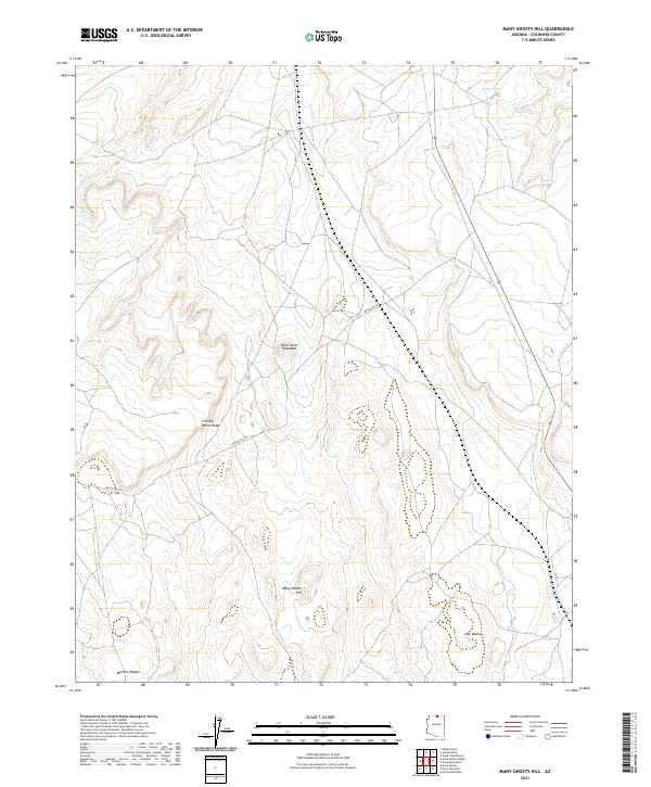
2021 Map of Many Ghosts Hill
USGS Topo · Published 2021About this map
Many Ghosts Hill rises as the central landmark in this high-elevation landscape of the Colorado Plateau within Coconino County. The terrain is defined by distinct topographical formations including the broad Wild Horse Trap Mesa and the striking Circular White Ridge, which characterize the local geography. Human passage through this area is primarily facilitated by Indian Rte 201, a road that cuts across the township and range lines to connect these isolated features. Water resources, though sparse, are represented by the seasonal Antelope Cr and the functional Alkali Tank, reflecting the arid environmental conditions of the region. To the south, the Mormon Ridges and the depression of Low Valley suggest the varied geological strata that have long influenced movement and land use across this part of northern Arizona.
Find a feature on this map
17 named features on this map. Tap any name to fly to it.
Don’t see what you’re looking for? This feature index may not catch every label — zoom into the map to look around manually.
Map Details
Editions of this 2021 Many Ghosts Hill Map
This is the sole edition of this map. No revisions or reprints were ever made.
Other maps of this area

1886 · Echo Cliffs
USGS Topo · 1:250,000

1891 · Echo Cliffs
USGS Topo · 1:250,000

1954 · Leche-E Rock
USGS Topo · 1:62,500

1954 · Navajo Creek
USGS Topo · 1:62,500

1956 · Marble Canyon
USGS Topo · 1:250,000

1959 · Marble Canyon
USGS Topo · 1:250,000

1961 · Marble Canyon
USGS Topo · 1:250,000
1981 · Horsethief Mesa
USGS Topo · 1:24,000
1982 · Arrowhead Mesa
USGS Topo · 1:24,000
1982 · Many Ghosts Hill
USGS Topo · 1:24,000