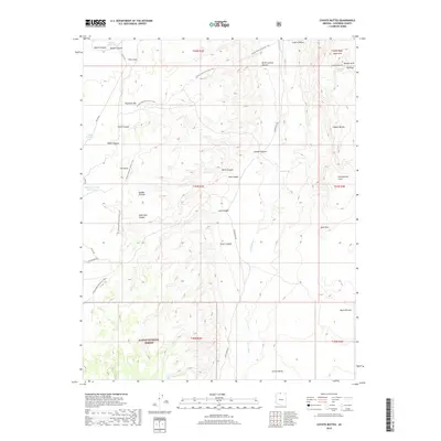
2018 Map of Coyote Buttes
USGS Topo · Published 2018About this map
Coyote Buttes and the eastern reaches of the Kaibab National Forest dominate this high-desert landscape, where geologic features and ephemeral water sources define the terrain. The Arizona National Scenic Trail winds through the western half of the map, passing below Buckskin Mtn and across The Basin as it follows the edge of the Kaibab Plateau. To the north, the drainage network includes Maries Canyon and several man-made catchments like Maries Reservoir and Middle Reservoir, essential for land management in this arid environment. Significant natural landmarks such as Joannes Arch and Dannys Arch are noted near Top Rock in the northeast. The presence of Old Arizona Rd and House Rock Rd indicates established access corridors through the rugged canyons of Long Canyon and Fence Canyon, leading toward the Coyote Valley.
Find a feature on this map
41 named features on this map. Tap any name to fly to it.
Don’t see what you’re looking for? This feature index may not catch every label — zoom into the map to look around manually.
Map Details
Editions of this 2018 Coyote Buttes Map
This is the sole edition of this map. No revisions or reprints were ever made.
Other maps of this area

1886 · Kanab
USGS Topo · 1:250,000

1886 · Escalante
USGS Topo · 1:250,000

1886 · Echo Cliffs
USGS Topo · 1:250,000

1886 · Kaibab
USGS Topo · 1:250,000

1891 · Echo Cliffs
USGS Topo · 1:250,000

1953 · Cedar City
USGS Topo · 1:250,000

1953 · Grand Canyon
USGS Topo · 1:250,000

1954 · Buckskin Gulch SE
USGS Topo · 1:24,000

1954 · Buckskin Gulch SW
USGS Topo · 1:24,000

1954 · Paria Plateau NW
USGS Topo · 1:24,000