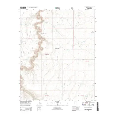
2014 Map of Hamilton Crossing
USGS Topo · Published 2014About this map
Whitted Place and Echinique Place stand as primary points of interest in this high-plateau region of Coconino County, where the landscape is defined by the winding drainages of Chevelon Cr and Willow Cr. This 2014 survey documents a territory split between the Coconino National Forest and Sitgreaves National Forest. The map reveals a complex system of livestock water management across the semi-arid terrain, evidenced by numerous named stock tanks such as Bargman Tank, Maverick Tank, and Surprise Tank. The transition from the deep relief of Echinique Draw to the prominence of Red Hill illustrates the varied topography of the Mogollon Rim country. A single primary artery, Tillman Rd, provides access through the eastern sections, connecting remote pastoral sites like the Tillman Tank to the broader regional network.
Find a feature on this map
30 named features on this map. Tap any name to fly to it.
Don’t see what you’re looking for? This feature index may not catch every label — zoom into the map to look around manually.
Map Details
Editions of this 2014 Hamilton Crossing Map
This is the sole edition of this map. No revisions or reprints were ever made.
Other maps of this area

1886 · Holbrook
USGS Topo · 1:250,000

1887 · Verde
USGS Topo · 1:250,000

1892 · Verde
USGS Topo · 1:250,000

1893 · Holbrook
USGS Topo · 1:250,000

1954 · Holbrook
USGS Topo · 1:250,000

1955 · Sunset Knoll 2 SW
USGS Topo · 1:24,000

1955 · Sunset Knoll 2 SE
USGS Topo · 1:24,000

1955 · Sunset Pass
USGS Topo · 1:62,500

1957 · Holbrook
USGS Topo · 1:250,000

1958 · Holbrook
USGS Topo · 1:250,000