
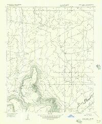
1955 Map of Sunset Knoll 2 SE
USGS Topo · Published 1957About this map
Clear Creek winds through the heart of this high plateau landscape, carving a deep, serpentine canyon that dominates the topography east of East Sunset Mountain. In the mid-1950s, this region near the border of Coconino Co and Navajo Co was defined by its water management for livestock, as evidenced by numerous infrastructure labels. Small-scale ranching operations are documented through several catchment features, including Pump Ranch Tank, Sims Tank, and an isolated Stock Tank. The presence of a Pump House and multiple Windmill sites across the sections indicates the necessity of groundwater extraction in this arid environment. Transportation at this time relied on unpaved routes, with distances noted toward the Winslow-Chevelon Road and Ariz. 65.
Find a feature on this map
11 named features on this map. Tap any name to fly to it.
Don’t see what you’re looking for? This feature index may not catch every label — zoom into the map to look around manually.
Map Details
Editions of this 1955 Sunset Knoll 2 SE Map
This is the sole edition of this map. No revisions or reprints were ever made.
Other maps of this area

1886 · Holbrook
USGS Topo · 1:250,000

1893 · Holbrook
USGS Topo · 1:250,000

1954 · Holbrook
USGS Topo · 1:250,000

1955 · Sunset Knoll 2 SW
USGS Topo · 1:24,000
1955 · Sunset Knoll 2 NW
USGS Topo · 1:24,000

1955 · Sunset Pass
USGS Topo · 1:62,500

1957 · Holbrook
USGS Topo · 1:250,000

1958 · Holbrook
USGS Topo · 1:250,000

1960 · Holbrook
USGS Topo · 1:250,000
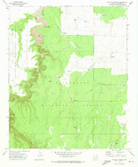
1970 · Hamilton Crossing
USGS Topo · 1:24,000