
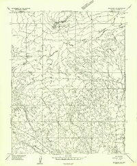
1957 Map of Shinarump SW
USGS Topo · Published 1958About this map
Ryan Road cuts across this high-desert landscape in northern Coconino County, serving as a primary corridor through a region defined by complex drainage patterns and livestock infrastructure. The topographical detail reveals a series of earthen dams and small reservoirs strategically placed to collect runoff from the surrounding plateaus. These water sources are critical to the usability of the grazing lands across White Sage Flat. The terrain is punctuated by distinctive landmarks such as Cedar Knoll and Little Cedar Knoll, which provide essential navigational points in the open country. Narrow, winding corridors like Pigeon Canyon and Wildcat Canyon highlight the erosional forces at work on the Arizona strip, showing the intricate relationship between the elevated flats and the deep-cut drainage systems that define the area's geography.
Find a feature on this map
8 named features on this map. Tap any name to fly to it.
Don’t see what you’re looking for? This feature index may not catch every label — zoom into the map to look around manually.
Map Details
Editions of this 1957 Shinarump SW Map
This is the sole edition of this map. No revisions or reprints were ever made.
Other maps of this area

1886 · Kaibab
USGS Topo · 1:250,000

1953 · Grand Canyon
USGS Topo · 1:250,000

1954 · Shinarump NW
USGS Topo · 1:24,000

1954 · Fredonia NE
USGS Topo · 1:24,000

1954 · Fredonia
USGS Topo · 1:62,500

1957 · Grand Canyon
USGS Topo · 1:250,000
1957 · Shinarump NE
USGS Topo · 1:24,000

1957 · Shinarump SE
USGS Topo · 1:24,000
1957 · Shinarump
USGS Topo · 1:62,500

1957 · Jumpup Canyon
USGS Topo · 1:62,500