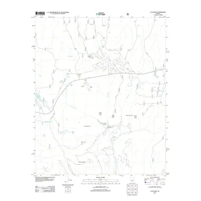
2011 Map of O W Point
USGS Topo · Published 2011About this map
Valentine Ridge and the high points of the Mogollon Rim define this landscape, where the waters of Canyon Creek descend through deep terrain toward the Canyon Creek Fish Hatchery. The 2011 survey reveals a region transitioning from ranching roots at Ryan Ranch and OW Ranch toward modern recreation. The Forest Lakes Trailhead and Larson Ridge Trailhead serve as gateways for exploration, while the Upper Canyon Creek Campground provides access to the creek's drainage. Numerous water tanks and small lakes, including Willow Springs Lake, Pinto Lake, and Jacob Lake, are scattered across the high country, reflecting the critical importance of water management in this high-elevation Arizona environment. Notable topographic landmarks such as North OW Point and Sheep Creek Point offer clear orientation within the dense network of forest roads.
Find a feature on this map
58 named features on this map. Tap any name to fly to it.
Don’t see what you’re looking for? This feature index may not catch every label — zoom into the map to look around manually.
Map Details
Editions of this 2011 O W Point Map
This is the sole edition of this map. No revisions or reprints were ever made.
Other maps of this area

1886 · Holbrook
USGS Topo · 1:250,000

1893 · Holbrook
USGS Topo · 1:250,000

1954 · Holbrook
USGS Topo · 1:250,000

1957 · Holbrook
USGS Topo · 1:250,000

1958 · Holbrook
USGS Topo · 1:250,000

1960 · Holbrook
USGS Topo · 1:250,000

1961 · Woods Canyon
USGS Topo · 1:62,500

1961 · Heber
USGS Topo · 1:62,500

1961 · Chediski Peak
USGS Topo · 1:62,500
1961 · Young
USGS Topo · 1:62,500