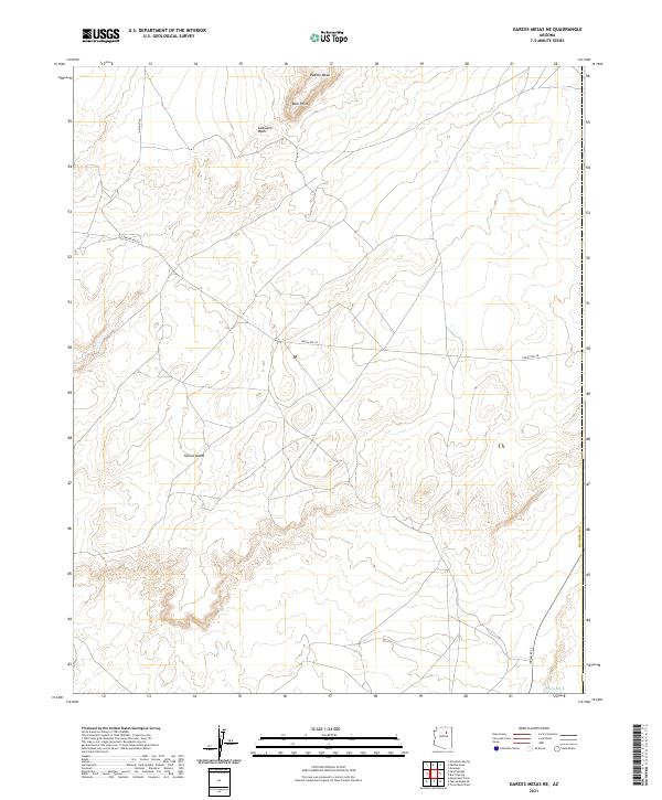
2021 Map of Garces Mesas NE
USGS Topo · Published 2021About this map
Padilla Mesa and the expansive Garces Mesas define this high-elevation landscape in Coconino County. The region is marked by significant topographic relief, where the land drops away from the level mesas into the winding drainage of Saltwater Wash and Oraibi Wash. Transportation through this territory relies on a network of established routes, specifically Indian Rte 9, Indian Rte 58, and Indian Rte 2, which traverse the high ground and bypass the more severe breaks in the terrain. The presence of Blue Point suggests a distinct navigational landmark within a survey area dominated by natural contours and administrative township boundaries, including the intersection of t27n r14e and t27n r15e.
Find a feature on this map
13 named features on this map. Tap any name to fly to it.
Don’t see what you’re looking for? This feature index may not catch every label — zoom into the map to look around manually.
Map Details
Editions of this 2021 Garces Mesas NE Map
This is the sole edition of this map. No revisions or reprints were ever made.
Other maps of this area

1883 · Tusayan
USGS Topo · 1:250,000

1886 · Tusayan
USGS Topo · 1:250,000

1947 · Flagstaff
USGS Topo · 1:250,000

1954 · Flagstaff
USGS Topo · 1:250,000

1958 · Flagstaff
USGS Topo · 1:250,000

1960 · Flagstaff
USGS Topo · 1:250,000

1962 · Flagstaff
USGS Topo · 1:250,000

1966 · Oraibi
USGS Topo · 1:62,500

1966 · Tovar Mesa
USGS Topo · 1:62,500
1967 · Sand Springs
USGS Topo · 1:24,000