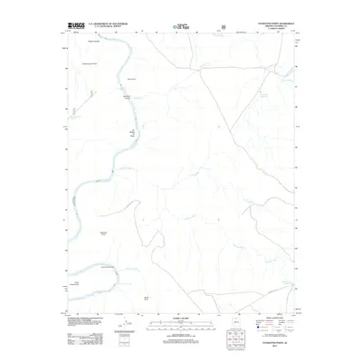
2012 Map of Tatahatso Point
USGS Topo · Published 2012About this map
The Colorado River carves a deep path through Coconino County in this 2012 survey, revealing a landscape defined by significant elevation changes and seasonal drainage. Geographic landmarks such as Tatahatso Point and Point Hansbrough overlook the winding water, which is punctuated by the churning waters of President Harding Rapids. The river corridor is home to unique features like Vaseys Paradise and The Bridge of Sighs, alongside technical features of the river such as Nautiloid Canyon and the notable Anasazi Foot Bridge.
Find a feature on this map
21 named features on this map. Tap any name to fly to it.
Don’t see what you’re looking for? This feature index may not catch every label — zoom into the map to look around manually.
Map Details
Editions of this 2012 Tatahatso Point Map
This is the sole edition of this map. No revisions or reprints were ever made.
Other maps of this area
1886 · Echo Cliffs
USGS Topo · 1:250,000
1891 · Echo Cliffs
USGS Topo · 1:250,000
1954 · Nankoweap
USGS Topo · 1:62,500
1954 · Tanner Wash
USGS Topo · 1:62,500
1954 · Emmett Wash
USGS Topo · 1:62,500
1954 · Shinumo Altar
USGS Topo · 1:62,500

1956 · Marble Canyon
USGS Topo · 1:250,000

1959 · Marble Canyon
USGS Topo · 1:250,000

1961 · Marble Canyon
USGS Topo · 1:250,000
1983 · Tuba City
USGS Topo · 1:100,000