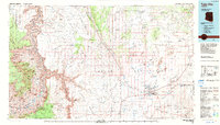
1983 Map of Tuba City
USGS Topo · Published 1983About this map
Tuba City and the neighboring settlement of Moenkopi serve as the primary hubs on this high-desert plateau within the Navajo Indian Reservation. The landscape is defined by massive geological formations, from the towering Echo Cliffs and Kaibito Plateau to the dramatic descent into Grand Canyon along the western edge. This 1980s data shows a sophisticated network of remote water sources essential for livestock and habitation, including Benally Well, Toh Nee Di Kishi, and Cattail Spring. Industrial footprints are visible at the Coal Mine on the Moenkopi Plateau and the Rare Metals Tailings Ponds northeast of the city. Notable landmarks like Apollo Temple and Cape Solitude overlook the confluence of the Colorado River and the Little Colorado River, marking the intersection of complex canyon topography and the open reaches of the Painted Desert.
Find a feature on this map
136 named features on this map. Tap any name to fly to it.
Don’t see what you’re looking for? This feature index may not catch every label — zoom into the map to look around manually.
Map Details
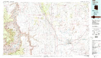
Editions of this 1983 Tuba City Map
2 editions found
Other maps of this area

1883 · Marsh Pass
USGS Topo · 1:250,000

1883 · Tusayan
USGS Topo · 1:250,000

1886 · Tusayan
USGS Topo · 1:250,000

1886 · San Francisco Mtns
USGS Topo · 1:250,000

1886 · Chino
USGS Topo · 1:250,000

1886 · Echo Cliffs
USGS Topo · 1:250,000

1886 · Kaibab
USGS Topo · 1:250,000

1891 · San Francisco Mtns
USGS Topo · 1:250,000

1891 · Chino
USGS Topo · 1:250,000

1891 · Echo Cliffs
USGS Topo · 1:250,000