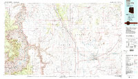
1983 Map of Tuba City
USGS Topo · Published 1983About this map
Tuba City and the neighboring hopi village of Moenkopi serve as the primary anchors in this early 1980s look at the western edge of the Navajo Indian Reservation. The landscape is defined by the sharp verticality of the Echo Cliffs and the deep incisions of Marble Canyon, where the Colorado River continues its descent toward the heart of the Grand Canyon. This era shows a high-desert environment balanced between ancestral traditions and modern infrastructure, evidenced by the proximity of the Tusayan Ruins and Museum to the coal-hauling routes near Black Mesa.
Find a feature on this map
65 named features on this map. Tap any name to fly to it.
Don’t see what you’re looking for? This feature index may not catch every label — zoom into the map to look around manually.
Map Details
Editions of this 1983 Tuba City Map
2 editions found
Other maps of this area

1883 · Marsh Pass
USGS Topo · 1:250,000

1883 · Tusayan
USGS Topo · 1:250,000

1886 · Tusayan
USGS Topo · 1:250,000

1886 · San Francisco Mtns
USGS Topo · 1:250,000

1886 · Chino
USGS Topo · 1:250,000

1886 · Echo Cliffs
USGS Topo · 1:250,000

1886 · Kaibab
USGS Topo · 1:250,000

1891 · San Francisco Mtns
USGS Topo · 1:250,000

1891 · Chino
USGS Topo · 1:250,000

1891 · Echo Cliffs
USGS Topo · 1:250,000