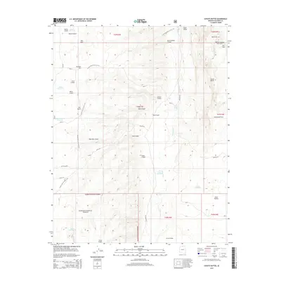
2014 Map of Coyote Buttes
USGS Topo · Published 2014About this map
Coyote Buttes and the high desert landforms of the Paria Plateau define this section of Coconino County. The map captures a landscape of extreme vertical relief, where drainage systems like Coyote Wash have carved deep recesses including Red Canyon and Larkum Canyon. Evidence of rare desert water sources is prominent, with several livestock-related developments such as Maries Reservoir, Lone Tree Reservoir, and Ladder Reservoir scattered across the arid terrain. The northern section of the Kaibab National Forest borders the plateau, intersected by the winding path of the Arizona National Scenic Trail. Geologic landmarks including Dannys Arch and Joannes Arch appear near Top Rock, highlighting the unique sandstone formations of the Vermilion Cliffs area. A network of Bureau of Land Management routes, such as Paw Hole Rd and House Rock Rd, provides the only access through this complex topography.
Find a feature on this map
53 named features on this map. Tap any name to fly to it.
Don’t see what you’re looking for? This feature index may not catch every label — zoom into the map to look around manually.
Map Details
Editions of this 2014 Coyote Buttes Map
This is the sole edition of this map. No revisions or reprints were ever made.
Other maps of this area

1886 · Kanab
USGS Topo · 1:250,000

1886 · Escalante
USGS Topo · 1:250,000

1886 · Echo Cliffs
USGS Topo · 1:250,000

1886 · Kaibab
USGS Topo · 1:250,000

1891 · Echo Cliffs
USGS Topo · 1:250,000

1953 · Cedar City
USGS Topo · 1:250,000

1953 · Grand Canyon
USGS Topo · 1:250,000

1954 · Buckskin Gulch SE
USGS Topo · 1:24,000

1954 · Buckskin Gulch SW
USGS Topo · 1:24,000

1954 · Paria Plateau NW
USGS Topo · 1:24,000