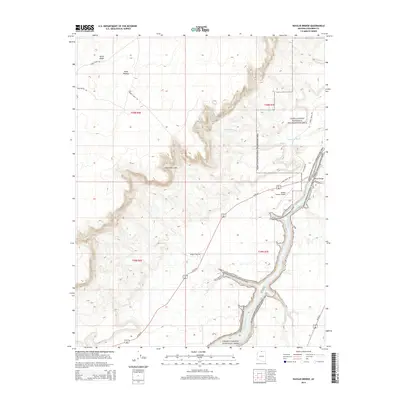
2014 Map of Navajo Bridge
USGS Topo · Published 2014About this map
The Colorado River carves a deep path through northern Coconino County, serving as the dramatic boundary between Grand Canyon National Park and Glen Canyon National Recreation Area. The landscape is dominated by the massive rise of the Vermilion Cliffs and the sweeping Paria Plateau, where relief is marked by features like Horse Ridge and deep drainage channels including Cathedral Wash and Jackass Cr. Human passage through this canyon country is concentrated around the Navajo Bridge, a critical crossing point for Us-89-Alt. Near the bridge, the Marble Canyon Airport provides a small aviation footprint in an otherwise wilderness-dominated setting. The road network, featuring routes such as Lees Ferry Rd and the historic Honey Moon Trl, reveals how transportation corridors have been forced to navigate the extreme topography of the Arizona strip.
Find a feature on this map
21 named features on this map. Tap any name to fly to it.
Don’t see what you’re looking for? This feature index may not catch every label — zoom into the map to look around manually.
Map Details
Editions of this 2014 Navajo Bridge Map
This is the sole edition of this map. No revisions or reprints were ever made.
Other maps of this area

1886 · Echo Cliffs
USGS Topo · 1:250,000

1891 · Echo Cliffs
USGS Topo · 1:250,000

1951 · Lees Ferry NE
USGS Topo · 1:24,000

1954 · Lees Ferry NW
USGS Topo · 1:24,000

1954 · Emmett Wash NE
USGS Topo · 1:24,000

1954 · Paria Plateau SE
USGS Topo · 1:24,000

1954 · Lees Ferry SE
USGS Topo · 1:24,000

1954 · Lees Ferry SW
USGS Topo · 1:24,000

1954 · Tanner Wash
USGS Topo · 1:62,500

1954 · Emmett Wash
USGS Topo · 1:62,500