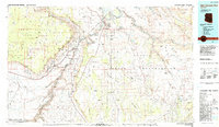
1984 Map of Glen Canyon Dam
USGS Topo · Published 1984About this map
Glen Canyon Dam anchors this northern Arizona landscape, where the waters of the Colorado River back up to form Lake Powell and its many inlets like Wahweap Bay and Labyrinth Bay. The city of Page stands as the primary settlement on the high ground near the dam, adjacent to the industrial footprint of the Navajo Generating Station. To the south and west, the terrain drops dramatically through the Vermilion Cliffs and Marble Canyon, where the Navajo Bridge provides a critical crossing over the gorge.
Find a feature on this map
50 named features on this map. Tap any name to fly to it.
Don’t see what you’re looking for? This feature index may not catch every label — zoom into the map to look around manually.
Map Details
Editions of this 1984 Glen Canyon Dam Map
2 editions found
Other maps of this area

1883 · Marsh Pass
USGS Topo · 1:250,000

1886 · Kanab
USGS Topo · 1:250,000

1886 · Escalante
USGS Topo · 1:250,000

1886 · Henry Mountains
USGS Topo · 1:250,000

1886 · Echo Cliffs
USGS Topo · 1:250,000

1886 · Kaibab
USGS Topo · 1:250,000

1891 · Echo Cliffs
USGS Topo · 1:250,000

1892 · Marsh Pass
USGS Topo · 1:250,000

1892 · Henry Mountains
USGS Topo · 1:250,000

1922 · Warm Creek
USGS Topo · 1:63,360