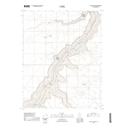
2018 Map of North Canyon Point
USGS Topo · Published 2018About this map
Grand Canyon National Park forms the heart of this landscape, where the high desert of House Rock Valley meets the dramatic vertical drop of Marble Canyon. This 2018 survey documents the river corridor as it existed in the early twenty-first century, tracing the Colorado River as it winds through deep-cut gorges. The map provides precise locations for several dangerous river features, including Hansbrough-Richards Rapid, Twentyfive Mile Rapids, and Twentynine Mile Rapids. Away from the river, the terrain rises toward North Canyon Point, where ephemeral drainage systems like N-Canyon-Wash and Shinumo Wash carve through the plateau. These washes are vital indicators of the region's hydrologic patterns, essential for understanding the seasonal water flow that has shaped the Arizona desert over millennia.
Find a feature on this map
27 named features on this map. Tap any name to fly to it.
Don’t see what you’re looking for? This feature index may not catch every label — zoom into the map to look around manually.
Map Details
Editions of this 2018 North Canyon Point Map
This is the sole edition of this map. No revisions or reprints were ever made.
Other maps of this area

1886 · Echo Cliffs
USGS Topo · 1:250,000

1891 · Echo Cliffs
USGS Topo · 1:250,000

1954 · Emmett Wash NE
USGS Topo · 1:24,000

1954 · Emmett Wash NW
USGS Topo · 1:24,000

1954 · Nankoweap
USGS Topo · 1:62,500

1954 · Tanner Wash
USGS Topo · 1:62,500

1954 · Emmett Wash
USGS Topo · 1:62,500

1954 · Shinumo Altar
USGS Topo · 1:62,500

1956 · Marble Canyon
USGS Topo · 1:250,000

1959 · Marble Canyon
USGS Topo · 1:250,000