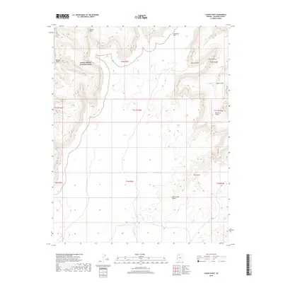
2018 Map of Yunosi Point
USGS Topo · Published 2018About this map
Grand Canyon National Park dominates the northwestern corner of this Coconino County terrain, where the high desert plateau is carved into a complex system of drainage basins. The landscape is defined by its verticality, transitioning from the heights of Flatiron Butte and Yumtheska Point down into deeply incised corridors such as National Canyon and Beaver Canyon. These natural features dictate the movement of water and any potential travel through the region, forming a labyrinthine geography characteristic of the Arizona strip. Evidence of water management in this arid environment appears at Bishop Tank, a critical focal point for livestock or wildlife. The map also identifies prominent landmarks like Yunosi Point, which overlooks the descent into Yunosi Canyon and the neighboring Whiterock Canyon, illustrating the sheer scale of erosion that has shaped this part of the Colorado Plateau.
Find a feature on this map
19 named features on this map. Tap any name to fly to it.
Don’t see what you’re looking for? This feature index may not catch every label — zoom into the map to look around manually.
Map Details
Editions of this 2018 Yunosi Point Map
This is the sole edition of this map. No revisions or reprints were ever made.
Other maps of this area

1886 · Kaibab
USGS Topo · 1:250,000

1953 · Grand Canyon
USGS Topo · 1:250,000

1957 · Grand Canyon
USGS Topo · 1:250,000

1958 · Grand Canyon
USGS Topo · 1:250,000

1960 · Grand Canyon
USGS Topo · 1:250,000

1962 · Kanab Point
USGS Topo · 1:62,500

1962 · Tuckup Canyon
USGS Topo · 1:62,500

1962 · Supai
USGS Topo · 1:62,500

1962 · National Canyon
USGS Topo · 1:62,500

1984 · Grand Canyon
USGS Topo · 1:100,000