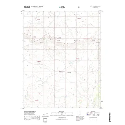
2018 Map of Toothpick Ridge
USGS Topo · Published 2018About this map
Kaibab National Forest dominates this Coconino County terrain, characterized by a series of steep escarpments and isolated water sources essential for high-desert navigation. The map follows the distinct Snake/Kanab route as it skirts the northern edge of Toothpick Ridge and the prominent Table Rock. This area is defined by its deep drainages, including Table Rock Canyon and Toothpick Canyon, which intersect the plateau.
Find a feature on this map
23 named features on this map. Tap any name to fly to it.
Don’t see what you’re looking for? This feature index may not catch every label — zoom into the map to look around manually.
Map Details
Editions of this 2018 Toothpick Ridge Map
This is the sole edition of this map. No revisions or reprints were ever made.
Other maps of this area

1886 · Kaibab
USGS Topo · 1:250,000

1953 · Grand Canyon
USGS Topo · 1:250,000

1954 · Fredonia
USGS Topo · 1:62,500

1957 · Grand Canyon
USGS Topo · 1:250,000

1957 · Shinarump SE
USGS Topo · 1:24,000

1957 · Shinarump SW
USGS Topo · 1:24,000
1957 · Shinarump
USGS Topo · 1:62,500

1957 · Jumpup Canyon
USGS Topo · 1:62,500

1958 · Grand Canyon
USGS Topo · 1:250,000

1958 · Big Springs
USGS Topo · 1:62,500