
1958 Map of Big Springs
USGS Topo · Published 1960About this map
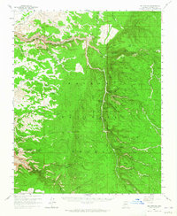
Ryan (Site) and the high plateau of the Kaibab National Forest define this landscape as it was documented in the late 1950s. The map reveals a high-elevation world of springs and seasonal water sources essential for early forest management and grazing, with the Big Springs Ranger Station serving as a primary administrative outpost. Evidence of much older habitation appears as Petroglyphs recorded near the canyons, while more modern remnants include Prospects and Ruins scattered through the drainages.
Find a feature on this map
79 named features on this map. Tap any name to fly to it.
Don’t see what you’re looking for? This feature index may not catch every label — zoom into the map to look around manually.
Map Details
Editions of this 1958 Big Springs Map
3 editions found
Other maps of this area

1886 · Kaibab
USGS Topo · 1:250,000

1936 · Jacobs Lake
USGS Topo · 1:48,000

1940 · Jacob Lake
USGS Topo · 1:62,500

1953 · Jacobs Lake
USGS Topo · 1:62,500

1953 · Grand Canyon
USGS Topo · 1:250,000

1954 · Fredonia
USGS Topo · 1:62,500

1957 · Grand Canyon
USGS Topo · 1:250,000

1957 · Shinarump SE
USGS Topo · 1:24,000
1957 · House Rock Spring SW
USGS Topo · 1:24,000

1957 · Shinarump SW
USGS Topo · 1:24,000