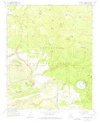
1965 Map of Stoneman Lake
USGS Topo · Published 1975About this map
Stoneman Lake serves as a focal point within this high-country landscape, surrounded by the steep drainages of Woods Canyon and Rattlesnake Canyon. This 1965 survey illustrates a wilderness defined by water management and topography, where numerous man-made and natural water sources like Bristow Tank, Potato Patch Tank, and Foster Spring supported livestock and wildlife throughout the Coconino National Forest. The map documents a rugged network of jeep trails providing access to isolated landmarks such as Lee Lookout Butte and the remote Woods Ranch.
Find a feature on this map
64 named features on this map. Tap any name to fly to it.
Don’t see what you’re looking for? This feature index may not catch every label — zoom into the map to look around manually.
Map Details
Editions of this 1965 Stoneman Lake Map
3 editions found
Other maps of this area

1887 · Verde
USGS Topo · 1:250,000

1892 · Verde
USGS Topo · 1:250,000

1923 · Camp Verde
USGS Topo · 1:125,000

1932 · Camp Verde
USGS Topo · 1:125,000

1936 · Camp Verde
USGS Topo · 1:125,000

1954 · Holbrook
USGS Topo · 1:250,000

1957 · Holbrook
USGS Topo · 1:250,000

1958 · Holbrook
USGS Topo · 1:250,000

1960 · Holbrook
USGS Topo · 1:250,000
1965 · Hutch Mtn.
USGS Topo · 1:24,000