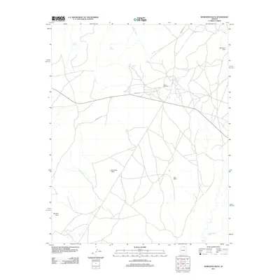
2011 Map of Whirlwind Rock
USGS Topo · Published 2011About this map
Hard Rock Mesa and Flat Mesa anchor this high desert landscape within Coconino County, defined by a network of seasonal water sources and tribal routes. In a region where reliable water is the primary driver of habitation, the map identifies critical points such as Begay Windmill, Red Spot Spring, and Old Farm Spring. The terrain is marked by distinctive formations including Whirlwind Rock and Big Rock Point, while drainage patterns like Navajo Creek and the Kletha Valley Wash dictate the flow of the local topography. Transportation across this remote expanse relies on a series of numbered roads, including Indian Rte-16, Indian Rte-22, and Indian Rte-6224, which connect scattered outposts and geographic landmarks throughout the quadrangle.
Find a feature on this map
14 named features on this map. Tap any name to fly to it.
Don’t see what you’re looking for? This feature index may not catch every label — zoom into the map to look around manually.
Map Details
Editions of this 2011 Whirlwind Rock Map
This is the sole edition of this map. No revisions or reprints were ever made.
Other maps of this area

1883 · Marsh Pass
USGS Topo · 1:250,000

1892 · Marsh Pass
USGS Topo · 1:250,000

1956 · Marble Canyon
USGS Topo · 1:250,000

1959 · Marble Canyon
USGS Topo · 1:250,000

1961 · Marble Canyon
USGS Topo · 1:250,000

1970 · Cow Springs
USGS Topo · 1:24,000

1970 · Square Butte
USGS Topo · 1:24,000

1970 · Black Mesa Wash NW
USGS Topo · 1:24,000

1970 · Whirlwind Rock
USGS Topo · 1:24,000
1970 · Two Red Mesas
USGS Topo · 1:24,000