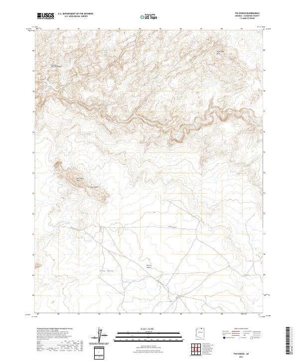
2021 Map of Tse Esgizii
USGS Topo · Published 2021About this map
Tsai Skizzi Rock and the high desert plateaus of Coconino County dominate this 2021 topographic survey. The landscape is defined by massive sandstone formations and dramatic elevation changes, notably the Fernholes Natural Bridge and the sprawling expanse of Gray Mesa. Water is a scarce but defining force here, represented by the winding path of Navajo Creek cutting through the northern sections of the quadrangle. Human presence is minimal and largely centered on the corridor of Indian Rte 6330, which provides the primary access through this high-altitude terrain. Land researchers can trace the legal boundaries of townships including t40n r12e and t39n r12.5e, while landmarks like the High Point Rock and the curiously named Pile of Sticks serve as essential navigational anchors in a region characterized by its isolated geological features.
Find a feature on this map
13 named features on this map. Tap any name to fly to it.
Don’t see what you’re looking for? This feature index may not catch every label — zoom into the map to look around manually.
Map Details
Editions of this 2021 Tse Esgizii Map
This is the sole edition of this map. No revisions or reprints were ever made.
Other maps of this area

1883 · Marsh Pass
USGS Topo · 1:250,000

1886 · Echo Cliffs
USGS Topo · 1:250,000

1891 · Echo Cliffs
USGS Topo · 1:250,000

1892 · Marsh Pass
USGS Topo · 1:250,000

1954 · Navajo Creek
USGS Topo · 1:62,500

1956 · Marble Canyon
USGS Topo · 1:250,000

1959 · Marble Canyon
USGS Topo · 1:250,000

1961 · Marble Canyon
USGS Topo · 1:250,000
1970 · Chaiyahi Rim SW
USGS Topo · 1:24,000
1970 · Two Red Mesas
USGS Topo · 1:24,000