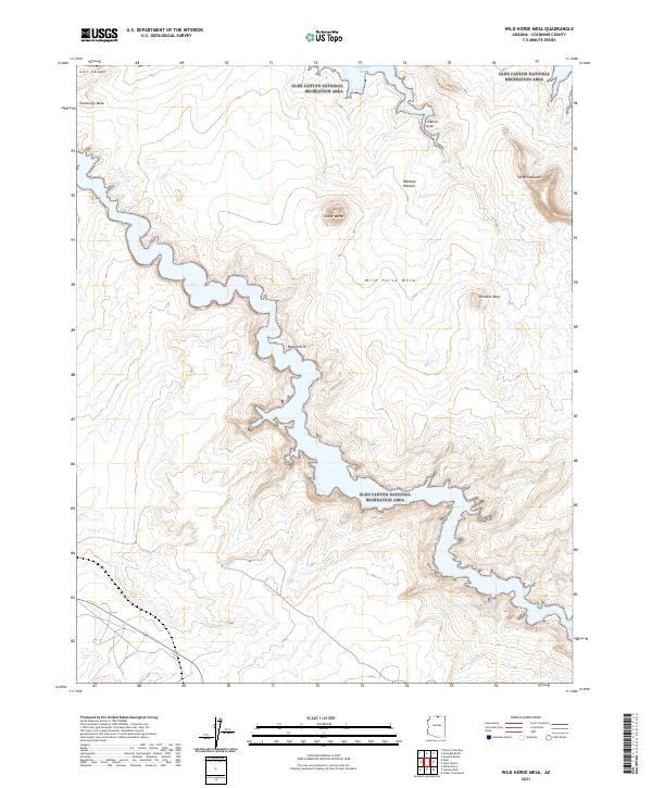
2021 Map of Wild Horse Mesa
USGS Topo · Published 2021About this map
Wild Horse Mesa dominates this Coconino County landscape, rising between the convoluted shorelines and dramatic sandstone formations within the Glen Canyon National Recreation Area. The intricate fingers of Navajo Canyon and the northern reach of Labyrinth Bay illustrate a topography shaped by desert erosion and rising reservoir waters. Distinctive landmarks like the isolated Tower Butte and the natural span of Navajo Arch provide clear reference points for those navigating this complex terrain. To the north and east, the Rainbow Plateau and the high elevations of Cummings Mesa frame the area's geological character, which includes specific cultural and geological markers such as Liitkiizh Shijei and Pinnacle Rock. The map details the transition from the high mesa tops to the deep-cut canyon floors, reflecting the vast drainage networks that define this part of Arizona.
Find a feature on this map
20 named features on this map. Tap any name to fly to it.
Don’t see what you’re looking for? This feature index may not catch every label — zoom into the map to look around manually.
Map Details
Editions of this 2021 Wild Horse Mesa Map
This is the sole edition of this map. No revisions or reprints were ever made.
Other maps of this area

1886 · Escalante
USGS Topo · 1:250,000

1886 · Echo Cliffs
USGS Topo · 1:250,000

1891 · Echo Cliffs
USGS Topo · 1:250,000

1922 · Warm Creek
USGS Topo · 1:63,360

1953 · Cummings Mesa
USGS Topo · 1:62,500

1953 · Gunsight Butte
USGS Topo · 1:62,500

1954 · Leche-E Rock
USGS Topo · 1:62,500

1954 · Navajo Creek
USGS Topo · 1:62,500

1956 · Escalante
USGS Topo · 1:250,000

1956 · Marble Canyon
USGS Topo · 1:250,000