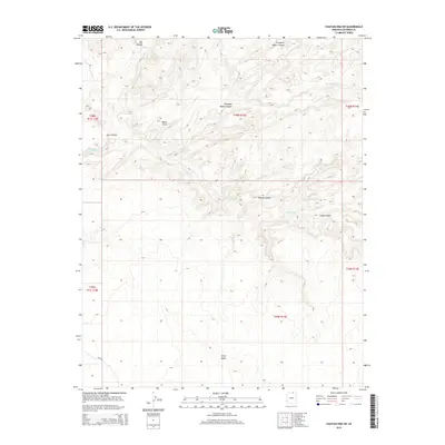
2014 Map of Chaiyahi Rim SW
USGS Topo · Published 2014About this map
Navajo Canyon and its many winding tributaries dominate this 2014 survey of Coconino County. The landscape is defined by a complex network of deep drainages, including the lengthy Long Canyon and the evocatively named Trampled Water Canyon, which flow through the high desert terrain. Notable landmarks like Mikes Arch and the broad Gray Mesa provide distinct elevation markers in an area where water has clearly shaped the earth over millennia.
Find a feature on this map
17 named features on this map. Tap any name to fly to it.
Don’t see what you’re looking for? This feature index may not catch every label — zoom into the map to look around manually.
Map Details
Editions of this 2014 Chaiyahi Rim SW Map
This is the sole edition of this map. No revisions or reprints were ever made.
Other maps of this area

1883 · Marsh Pass
USGS Topo · 1:250,000

1886 · Echo Cliffs
USGS Topo · 1:250,000

1891 · Echo Cliffs
USGS Topo · 1:250,000

1892 · Marsh Pass
USGS Topo · 1:250,000

1954 · Navajo Creek
USGS Topo · 1:62,500

1956 · Marble Canyon
USGS Topo · 1:250,000

1959 · Marble Canyon
USGS Topo · 1:250,000

1961 · Marble Canyon
USGS Topo · 1:250,000
1970 · Chaiyahi Rim SW
USGS Topo · 1:24,000
1970 · Two Red Mesas
USGS Topo · 1:24,000