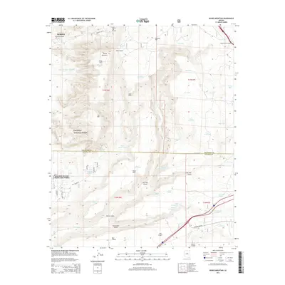
2014 Map of Munds Mountain
USGS Topo · Published 2014About this map
Sedona and the Village of Oak Creek (Big Park) anchor this 2014 survey of the Red Rock country, where the Coconino National Forest encompasses high desert plateaus and deep drainage systems. The landscape is dominated by massive formations such as Munds Mountain and Lee Mtn, with the iconic Schnebly Hill and Merry-Go-Round providing distinct vertical relief. The map reveals an intricate network of water management in a dry climate, evidenced by dozens of named tanks like Bear Tank, Coyote Pup Tank, and Horse Trap Tank scattered across the high ground.
Find a feature on this map
59 named features on this map. Tap any name to fly to it.
Don’t see what you’re looking for? This feature index may not catch every label — zoom into the map to look around manually.
Map Details
Editions of this 2014 Munds Mountain Map
This is the sole edition of this map. No revisions or reprints were ever made.
Other maps of this area

1887 · Verde
USGS Topo · 1:250,000

1892 · Verde
USGS Topo · 1:250,000

1923 · Camp Verde
USGS Topo · 1:125,000

1932 · Camp Verde
USGS Topo · 1:125,000

1936 · Camp Verde
USGS Topo · 1:125,000

1954 · Holbrook
USGS Topo · 1:250,000

1957 · Holbrook
USGS Topo · 1:250,000

1958 · Holbrook
USGS Topo · 1:250,000

1960 · Holbrook
USGS Topo · 1:250,000
1965 · Munds Mountain
USGS Topo · 1:24,000