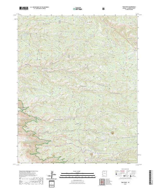
2023 Map of Timp Point
USGS Topo · Published 2023About this map
Kaibab National Forest and Grand Canyon National Park converge in this high-altitude landscape of the Kaibab Plateau, where dramatic rims overlook deeply carved canyons. The map documents an intricate network of drainage systems, including the headwaters of Tapeats Creek and the sheer drops of Timp Canyon and Parissawampitts Canyon. Settlement is represented by essential water management features like Burnt Corral Tank and Trick Tank, which provide critical resources in this arid environment. Recreational access is detailed through various paths such as the Rainbow Rim Trl and the N Timp Snowmobile Trl, which follow the contours of the plateau. Notable landforms like Timp Point and Locust Point serve as primary overlooks into the vast geologic formations, while scattered water sources like Bee Spring and Quaking Aspen Spring indicate the locations of life-sustaining seeps along the canyon walls.
Find a feature on this map
53 named features on this map. Tap any name to fly to it.
Don’t see what you’re looking for? This feature index may not catch every label — zoom into the map to look around manually.
Map Details
Editions of this 2023 Timp Point Map
This is the sole edition of this map. No revisions or reprints were ever made.
Other maps of this area

1886 · Kaibab
USGS Topo · 1:250,000

1936 · Jacobs Lake
USGS Topo · 1:48,000

1940 · Jacob Lake
USGS Topo · 1:62,500

1953 · Jacobs Lake
USGS Topo · 1:62,500

1953 · Grand Canyon
USGS Topo · 1:250,000

1957 · Grand Canyon
USGS Topo · 1:250,000

1958 · Grand Canyon
USGS Topo · 1:250,000

1958 · Big Springs
USGS Topo · 1:62,500

1960 · Grand Canyon
USGS Topo · 1:250,000

1962 · De Motte Park
USGS Topo · 1:62,500