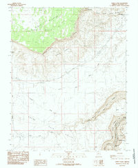
1985 Map of Emmett Wash
USGS Topo · Published 1985About this map
The Vermilion Cliffs form a dramatic geological boundary across this landscape, separating the high Paria Plateau and its Sand Hills from the lower elevations of House Rock Valley. In the northeast, the Cliff Dwellers Lodge stands as a rare point of human habitation near the Soap Creek Bench. The eastern edge of the map is dominated by the deep cut of Marble Canyon, where the Colorado River surges through North Canyon Rapids. This 1985 survey illustrates the intersection of several distinct land managements, including portions of Grand Canyon National Park and the Navajo Indian Reservation. The terrain is characterized by a network of drainage systems like Soap Creek and Emmett Wash, which carve through the benchlands and cliffs toward the river.
Find a feature on this map
25 named features on this map. Tap any name to fly to it.
Don’t see what you’re looking for? This feature index may not catch every label — zoom into the map to look around manually.
Map Details
Editions of this 1985 Emmett Wash Map
This is the sole edition of this map. No revisions or reprints were ever made.
Other maps of this area

1886 · Echo Cliffs
USGS Topo · 1:250,000

1891 · Echo Cliffs
USGS Topo · 1:250,000

1954 · Emmett Wash NE
USGS Topo · 1:24,000

1954 · Emmett Wash NW
USGS Topo · 1:24,000

1954 · Paria Plateau SE
USGS Topo · 1:24,000

1954 · Paria Plateau SW
USGS Topo · 1:24,000

1954 · Lees Ferry SW
USGS Topo · 1:24,000

1954 · Tanner Wash
USGS Topo · 1:62,500

1954 · Emmett Wash
USGS Topo · 1:62,500

1954 · Lees Ferry
USGS Topo · 1:62,500