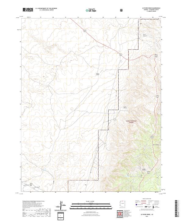
2021 Map of Le Fevre Ridge
USGS Topo · Published 2021About this map
Kaibab National Forest dominates the southern reaches of this landscape, where the high terrain of the Kaibab Plateau descends into a complex network of canyons and ridges. Modern transportation routes like Alt 89 and Ryan Rd cut across the northern flats and southern elevations, following the natural contours of the land near Lefevre Ridge. This 2021 survey illustrates a region largely defined by its natural topography and resource management, rather than dense settlement.
Find a feature on this map
15 named features on this map. Tap any name to fly to it.
Don’t see what you’re looking for? This feature index may not catch every label — zoom into the map to look around manually.
Map Details
Editions of this 2021 Le Fevre Ridge Map
This is the sole edition of this map. No revisions or reprints were ever made.
Other maps of this area

1886 · Kaibab
USGS Topo · 1:250,000

1936 · Jacobs Lake
USGS Topo · 1:48,000

1940 · Jacob Lake
USGS Topo · 1:62,500

1953 · Jacobs Lake
USGS Topo · 1:62,500

1953 · Grand Canyon
USGS Topo · 1:250,000

1954 · Shinarump NW
USGS Topo · 1:24,000

1957 · Grand Canyon
USGS Topo · 1:250,000
1957 · Shinarump NE
USGS Topo · 1:24,000
1957 · House Rock Spring NW
USGS Topo · 1:24,000

1957 · Shinarump SE
USGS Topo · 1:24,000