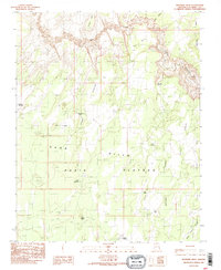
1985 Map of Wrather Arch
USGS Topo · Published 1985About this map
Wrather Arch stands as a prominent natural landmark within the complex terrain of the Paria Canyon corridor during the mid-1980s. This survey illustrates a landscape defined by the winding course of the Paria River as it carves through the massive Paria Plateau. The presence of several family-named or utilitarian water sources, such as Mackelprang Tank, Franks Reservoir, and Lynn Tank, indicates the vital importance of water management for cattle ranching across these arid uplands.
Find a feature on this map
25 named features on this map. Tap any name to fly to it.
Don’t see what you’re looking for? This feature index may not catch every label — zoom into the map to look around manually.
Map Details
Editions of this 1985 Wrather Arch Map
2 editions found
Other maps of this area

1886 · Escalante
USGS Topo · 1:250,000

1886 · Echo Cliffs
USGS Topo · 1:250,000

1891 · Echo Cliffs
USGS Topo · 1:250,000

1953 · Nipple Butte
USGS Topo · 1:62,500

1954 · Lees Ferry NW
USGS Topo · 1:24,000

1954 · Paria Plateau SE
USGS Topo · 1:24,000

1954 · Paria Plateau NW
USGS Topo · 1:24,000

1954 · Paria Plateau SW
USGS Topo · 1:24,000

1954 · Lees Ferry SW
USGS Topo · 1:24,000

1954 · Lees Ferry
USGS Topo · 1:62,500