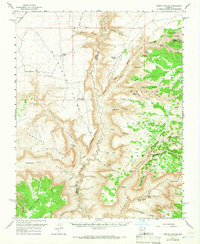
1957 Map of Jumpup Canyon
USGS Topo · Published 1966About this map
Kaibab National Forest dominates the eastern half of this landscape, where the plateaus drop sharply into the complex drainage systems of the Kanab Creek basin. The area is defined by its verticality and reliance on scarce water sources, evidenced by the numerous isolated springs such as Pigeon Spring and Wildband Spring tucked into canyon alcoves. A significant cultural marker is noted near the canyon rim with the presence of Petroglyphs overlooking the Willow Point area, suggesting a long history of human movement through these corridors.
Find a feature on this map
65 named features on this map. Tap any name to fly to it.
Don’t see what you’re looking for? This feature index may not catch every label — zoom into the map to look around manually.
Map Details
Editions of this 1957 Jumpup Canyon Map
2 editions found

Other maps of this area

1886 · Kaibab
USGS Topo · 1:250,000

1953 · Grand Canyon
USGS Topo · 1:250,000

1954 · Short Creek SE
USGS Topo · 1:24,000

1954 · Heaton Knolls SE
USGS Topo · 1:24,000

1954 · Fredonia SW
USGS Topo · 1:24,000

1954 · Fredonia
USGS Topo · 1:62,500

1954 · Short Creek
USGS Topo · 1:62,500

1954 · Heaton Knolls
USGS Topo · 1:62,500

1957 · Grand Canyon
USGS Topo · 1:250,000

1957 · Shinarump SW
USGS Topo · 1:24,000