
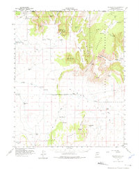
1954 Map of Short Creek
USGS Topo · Published 1959About this map
Short Creek and the surrounding borderlands of the Kaibab Indian Reservation define this mid-century topographic record. The landscape is dominated by the massive rise of the Vermilion Cliffs and the Moccasin Mountains, creating a rugged backdrop for small, isolated settlements like Cane Beds and Moccasin. The map reveals a livestock-focused economy dependent on widely scattered water sources such as Yellowstone Spring, Gudger Well, and Fern Tank.
Find a feature on this map
60 named features on this map. Tap any name to fly to it.
Don’t see what you’re looking for? This feature index may not catch every label — zoom into the map to look around manually.
Map Details
Editions of this 1954 Short Creek Map
2 editions found
Other maps of this area

1885 · St. George
USGS Topo · 1:250,000

1886 · Kanab
USGS Topo · 1:250,000

1886 · Mt. Trumbull
USGS Topo · 1:250,000

1886 · Kaibab
USGS Topo · 1:250,000

1891 · St. George
USGS Topo · 1:250,000

1892 · Mt. Trumbull
USGS Topo · 1:250,000

1953 · Cedar City
USGS Topo · 1:250,000

1953 · Grand Canyon
USGS Topo · 1:250,000

1954 · La Verkin 4 SE
USGS Topo · 1:24,000

1954 · Kanab SW
USGS Topo · 1:24,000