
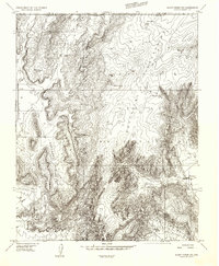
1954 Map of Fredonia SW
USGS Topo · Published 1956About this map
Pipe Spring National Monument serves as a focal point in the northwest corner of this mid-century survey, situated at the base of the Moccasin Mountains. Much of the landscape is defined by the Kaibab Indian Reservation, where the drainage patterns of Moccasin Wash and Sand Wash carve through the high desert. The terrain transitions into dramatic relief toward the south, where Burnt Canyon and Bull Rush Wash drop away from the surrounding flats. Local travel is dictated by the Mt Trumbull Road, which links these remote water sources like Twomile Seep and Bitter Seeps Wash. The map documents a sparsely settled region where survival depended on specific landmarks like Scotts Hole and various unnamed windmills and stock ponds that supported the local ranching economy.
Find a feature on this map
18 named features on this map. Tap any name to fly to it.
Don’t see what you’re looking for? This feature index may not catch every label — zoom into the map to look around manually.
Map Details
Editions of this 1954 Fredonia SW Map
This is the sole edition of this map. No revisions or reprints were ever made.
Other maps of this area

1886 · Kaibab
USGS Topo · 1:250,000

1953 · Grand Canyon
USGS Topo · 1:250,000

1954 · Fredonia NW
USGS Topo · 1:24,000

1954 · Short Creek SE
USGS Topo · 1:24,000

1954 · Fredonia NE
USGS Topo · 1:24,000

1954 · Fredonia
USGS Topo · 1:62,500

1954 · Short Creek
USGS Topo · 1:62,500

1954 · Heaton Knolls
USGS Topo · 1:62,500
1956 · Short Creek NE
USGS Topo · 1:24,000

1957 · Grand Canyon
USGS Topo · 1:250,000