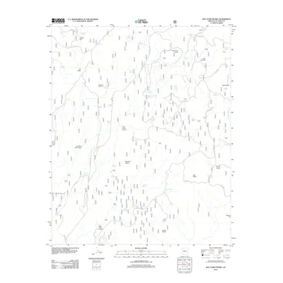
2012 Map of May Tank Pocket
USGS Topo · Published 2012About this map
May Tank Pocket and Secret Pocket sit within a high-elevation landscape defined by volcanic geology and intermittent water sources. This high-desert terrain is marked by essential livestock and wildlife watering points such as Bear Springs, Mud Springs, and the May Tank Canyon drainage. The land alternates between prominent high points like Davenport Knoll and Buzzard Knoll, and broad plateaus like Pine Flat and Little Pine Flat. A sophisticated network of forest roads, including S Perkinsville Rd and Bear Springs Rd, provides access across this territory, linking numerous named tanks and springs. The map documents a landscape of essential utility, where natural features like Wild Horse Canyon and Rocky Ridge dictate the movement of both modern vehicles and the herds that have historically relied on these remote water catchments.
Find a feature on this map
71 named features on this map. Tap any name to fly to it.
Don’t see what you’re looking for? This feature index may not catch every label — zoom into the map to look around manually.
Map Details
Editions of this 2012 May Tank Pocket Map
This is the sole edition of this map. No revisions or reprints were ever made.
Other maps of this area

1886 · Chino
USGS Topo · 1:250,000

1887 · Prescott
USGS Topo · 1:250,000

1891 · Chino
USGS Topo · 1:250,000

1892 · Prescott
USGS Topo · 1:250,000

1905 · Jerome
USGS Topo · 1:125,000

1922 · Williams
USGS Topo · 1:125,000

1944 · Clarkdale
USGS Topo · 1:48,000

1947 · Ash Fork
USGS Topo · 1:62,500

1947 · Paulden
USGS Topo · 1:62,500

1948 · Ash Fork
USGS Topo · 1:63,360