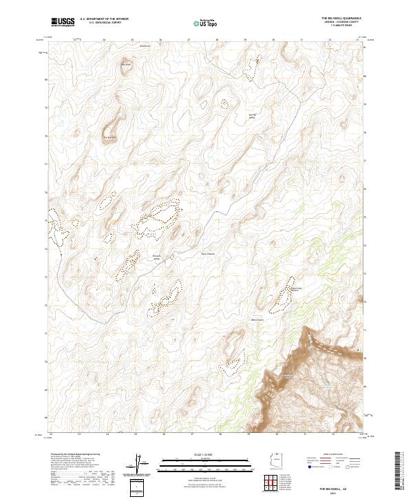
2021 Map of The Big Knoll
USGS Topo · Published 2021About this map
The Vermilion Cliffs dominate the southeastern portion of this landscape, creating a dramatic topographical transition in the Coconino County high desert. This 2021 survey of the Paria Plateau region illustrates a remote environment defined by distinct geologic formations rather than human settlement. Notable landmarks including The Big Knoll, Red Knolls, and Mid Knoll rise above the surrounding terrain, providing vertical relief in an area characterized by wide basins like Pinnacle Valley and Kid Pen Valley. Water is a scarce and vital resource in this arid climate, with Cottonwood Spring serving as a key hydrologic feature near the cliffs. The presence of Soap Creek Pasture suggests the continued use of this land for rangeland and grazing, a practice long established on the plateau despite its distance from major townships.
Find a feature on this map
15 named features on this map. Tap any name to fly to it.
Don’t see what you’re looking for? This feature index may not catch every label — zoom into the map to look around manually.
Map Details
Editions of this 2021 The Big Knoll Map
This is the sole edition of this map. No revisions or reprints were ever made.
Other maps of this area

1886 · Echo Cliffs
USGS Topo · 1:250,000

1891 · Echo Cliffs
USGS Topo · 1:250,000

1954 · Lees Ferry NW
USGS Topo · 1:24,000

1954 · Emmett Wash NE
USGS Topo · 1:24,000

1954 · Emmett Wash NW
USGS Topo · 1:24,000

1954 · Paria Plateau SE
USGS Topo · 1:24,000

1954 · Paria Plateau NW
USGS Topo · 1:24,000

1954 · Paria Plateau SW
USGS Topo · 1:24,000

1954 · Lees Ferry SW
USGS Topo · 1:24,000

1954 · Tanner Wash
USGS Topo · 1:62,500