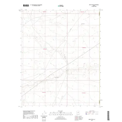
2018 Map of Rock Station
USGS Topo · Published 2018About this map
Rock Station marks a critical point of human presence in this arid landscape, situated where the terrain begins to slope toward the drainage of Jacks Canyon. This high desert environment is defined by its water management, evidenced by the distribution of catchment points such as Coon Tank, Prairie Dog Tank, and Highway Tanks. These features are vital markers for both historical land use and modern range management in Coconino County. The topography is further punctuated by the Toltec Divide, which separates distinct drainage basins in this region. The network of historical land divisions, including t18n r14e and t18n r15e, shows the systematic township and range surveying that carved this territory into manageable parcels. Wellfield Rd provides one of the few managed access points through the open country, connecting isolated points across the high plateaus.
Find a feature on this map
14 named features on this map. Tap any name to fly to it.
Don’t see what you’re looking for? This feature index may not catch every label — zoom into the map to look around manually.
Map Details
Editions of this 2018 Rock Station Map
This is the sole edition of this map. No revisions or reprints were ever made.
Other maps of this area

1883 · Tusayan
USGS Topo · 1:250,000

1886 · Tusayan
USGS Topo · 1:250,000

1886 · Holbrook
USGS Topo · 1:250,000

1893 · Holbrook
USGS Topo · 1:250,000

1947 · Flagstaff
USGS Topo · 1:250,000

1954 · Winslow
USGS Topo · 1:62,500

1954 · Winslow 4 SW
USGS Topo · 1:24,000

1954 · Flagstaff
USGS Topo · 1:250,000

1954 · Holbrook
USGS Topo · 1:250,000

1955 · Sunset Knoll 2 SW
USGS Topo · 1:24,000