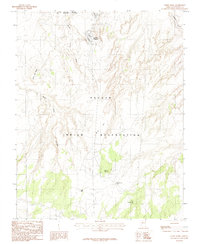
1985 Map of White Dome
USGS Topo · Published 1985About this map
Leche-e Chapter serves as a focal point of this arid landscape within the Navajo Indian Reservation. The map captures a high desert environment characterized by complex drainage systems and prominent landforms such as Wide Flat Mesa and the distinctively shaped White Dome. Settlement patterns are sparse, with notable activity concentrated near the Page Corporate Boundary in the northern reaches, where industrial and utility features like Sewage Disposal Ponds and a Gravel Pit are situated.
Find a feature on this map
14 named features on this map. Tap any name to fly to it.
Don’t see what you’re looking for? This feature index may not catch every label — zoom into the map to look around manually.
Map Details
Editions of this 1985 White Dome Map
This is the sole edition of this map. No revisions or reprints were ever made.
Other maps of this area

1886 · Echo Cliffs
USGS Topo · 1:250,000

1891 · Echo Cliffs
USGS Topo · 1:250,000

1951 · Lees Ferry NE
USGS Topo · 1:24,000

1954 · Lees Ferry SE
USGS Topo · 1:24,000

1954 · Tanner Wash
USGS Topo · 1:62,500

1954 · Leche-E Rock
USGS Topo · 1:62,500

1954 · Lees Ferry
USGS Topo · 1:62,500

1955 · Tanner Wash NE
USGS Topo · 1:24,000

1956 · Marble Canyon
USGS Topo · 1:250,000

1959 · Marble Canyon
USGS Topo · 1:250,000