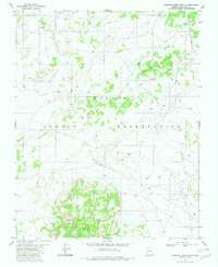
1982 Map of Preston Mesa North
USGS Topo · Published 1982About this map
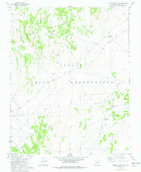
Preston Mesa rises prominently in the southern portion of this high-altitude landscape, part of the extensive Navajo Indian Reservation in northern Arizona. The terrain is defined by dramatic geological features, including the winding spine of Crooked Ridge and the edge of Black Mesa. Land use at the time of this 1982 edition appears centered on livestock and natural resource extraction, evidenced by several scattered Corrals and a Quarry. The intricate network of unimproved roads and trails shown suggests a sparsely populated region where movement followed the natural contours of the mesas and ridges. This map provides a look at the topographical isolation and specific land-management practices of the reservation before the transition into the modern era.
Find a feature on this map
6 named features on this map. Tap any name to fly to it.
Don’t see what you’re looking for? This feature index may not catch every label — zoom into the map to look around manually.
Map Details
Editions of this 1982 Preston Mesa North Map
This is the sole edition of this map. No revisions or reprints were ever made.
Other maps of this area

1886 · Echo Cliffs
USGS Topo · 1:250,000

1891 · Echo Cliffs
USGS Topo · 1:250,000

1956 · Marble Canyon
USGS Topo · 1:250,000

1959 · Marble Canyon
USGS Topo · 1:250,000

1961 · Marble Canyon
USGS Topo · 1:250,000
1981 · Big Whisker Well
USGS Topo · 1:24,000
1981 · Kaibito
USGS Topo · 1:24,000
1982 · Gopher Spring
USGS Topo · 1:24,000
1982 · Sitting Coyote Hill
USGS Topo · 1:24,000
1982 · Arrowhead Mesa
USGS Topo · 1:24,000