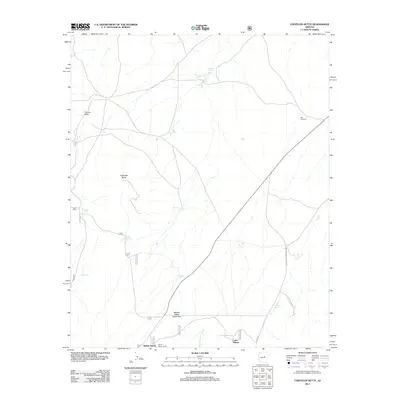
2011 Map of Chevelon Butte
USGS Topo · Published 2011About this map
Chevelon Butte stands as the primary landmark in this high-desert ranching landscape of Northern Arizona. This region is characterized by extensive water management systems essential for livestock, including the Babbitt Water Catchment and a series of reservoirs like Babbitt Tank, Broken Tank, and Mormon Tank. The presence of the Babbit Winter Ranch and Babbit Winter settlements underscores the area's history of seasonal cattle ranching and the influence of the Babbitt family. The terrain is marked by seasonal drainage patterns, most notably West Chevelon Creek and Tillman Draw, which converge near Lower Tillman. Historic travel routes, such as the Heber-Mormon Crossing Rd, suggest early pioneer movement through the Coconino plateau, while the isolated Big Windmill serves as a lone marker of modern utility in the open country.
Find a feature on this map
20 named features on this map. Tap any name to fly to it.
Don’t see what you’re looking for? This feature index may not catch every label — zoom into the map to look around manually.
Map Details
Editions of this 2011 Chevelon Butte Map
This is the sole edition of this map. No revisions or reprints were ever made.
Other maps of this area

1886 · Holbrook
USGS Topo · 1:250,000

1893 · Holbrook
USGS Topo · 1:250,000

1954 · Holbrook
USGS Topo · 1:250,000

1955 · Sunset Knoll 2 SW
USGS Topo · 1:24,000

1955 · Sunset Knoll 2 SE
USGS Topo · 1:24,000

1955 · Sunset Pass
USGS Topo · 1:62,500

1957 · Holbrook
USGS Topo · 1:250,000

1958 · Holbrook
USGS Topo · 1:250,000

1960 · Holbrook
USGS Topo · 1:250,000
1965 · Grama Draw
USGS Topo · 1:24,000