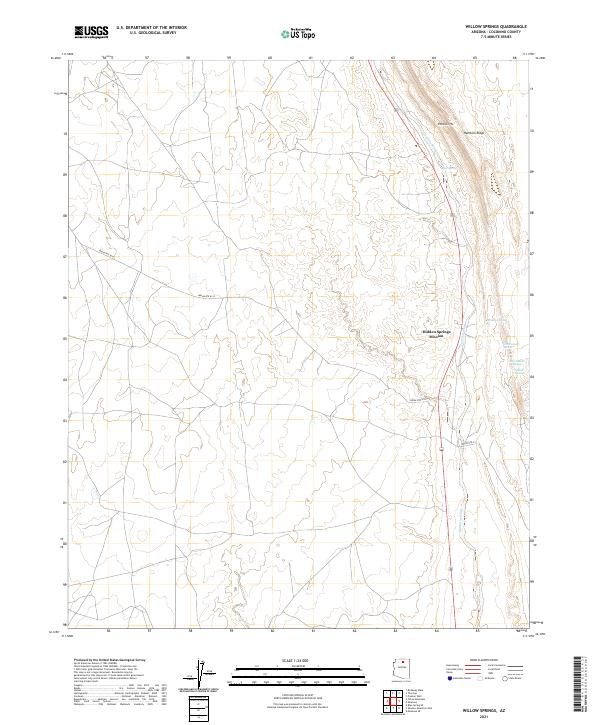
2021 Map of Willow Springs
USGS Topo · Published 2021About this map
The Echo Cliffs dominate this Coconino County landscape, rising sharply above the expansive drainage of Hamblin Wash. This desert environment is defined by its scarce but vital water sources, with several named springs clustered along the eastern slopes of Hamblin Ridge. The presence of Willow Springs, Jack Homer Spring, and Government Spring suggests a traditional reliance on these reliable aquifers in an otherwise arid basin.
Find a feature on this map
16 named features on this map. Tap any name to fly to it.
Don’t see what you’re looking for? This feature index may not catch every label — zoom into the map to look around manually.
Map Details
Editions of this 2021 Willow Springs Map
This is the sole edition of this map. No revisions or reprints were ever made.
Other maps of this area

1886 · Echo Cliffs
USGS Topo · 1:250,000

1891 · Echo Cliffs
USGS Topo · 1:250,000

1954 · Shinumo Altar SE
USGS Topo · 1:24,000

1954 · Shinumo Altar
USGS Topo · 1:62,500

1955 · Blue Spring NE
USGS Topo · 1:24,000
1955 · Blue Spring SE
USGS Topo · 1:24,000

1955 · Moa Ave NW
USGS Topo · 1:24,000
1955 · Moa Ave SW
USGS Topo · 1:24,000

1955 · Blue Spring
USGS Topo · 1:62,500

1956 · Marble Canyon
USGS Topo · 1:250,000