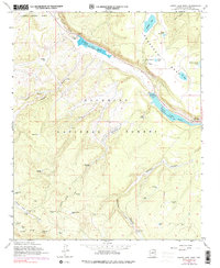
1962 Map of Lower Lake Mary
USGS Topo · Published 1990About this map
Lower Lake Mary and its counterpart Upper Lake Mary anchor this high-altitude landscape south of the Flagstaff corporate boundary. The area is characterized by scientific installations and forest management within the Coconino National Forest. Scientific progress is evident at the USGS Observatory and the Perkins Telescope situated atop Anderson Mesa. This elevated plateau provides a distinct contrast to the deep cuts of Newman Canyon and Walnut Creek.
Find a feature on this map
50 named features on this map. Tap any name to fly to it.
Don’t see what you’re looking for? This feature index may not catch every label — zoom into the map to look around manually.
Map Details
Editions of this 1962 Lower Lake Mary Map
4 editions found
Other maps of this area

1886 · San Francisco Mtns
USGS Topo · 1:250,000

1887 · Verde
USGS Topo · 1:250,000

1891 · San Francisco Mtns
USGS Topo · 1:250,000

1892 · Verde
USGS Topo · 1:250,000

1894 · San Francisco Mtns
USGS Topo · 1:250,000

1899 · San Francisco Mtns
USGS Topo · 1:250,000

1908 · Flagstaff
USGS Topo · 1:125,000

1912 · Flagstaff
USGS Topo · 1:125,000

1923 · Camp Verde
USGS Topo · 1:125,000

1932 · Camp Verde
USGS Topo · 1:125,000