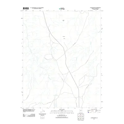
2011 Map of LeChee Rock
USGS Topo · Published 2011About this map
LeChee Rock stands as the primary landmark in this arid portion of Coconino County, characterized by a complex network of ephemeral drainages and essential water-catchment features. The landscape is defined by the winding course of Antelope Creek and the long stretch of Sand Wash, which represent the primary hydrological conduits through the high desert terrain. Localized peaks such as Nurusse and Betay rise above the surrounding flats, providing distinct reference points in a region where water sources like Antelope Tank and Alkali Tank were historically vital for livestock and travel. A sparse network of roads, many identified simply as Forest Service Rd, crisscrosses the map, illustrating the remote and managed nature of the land at the time of this 2011 survey.
Find a feature on this map
8 named features on this map. Tap any name to fly to it.
Don’t see what you’re looking for? This feature index may not catch every label — zoom into the map to look around manually.
Map Details
Editions of this 2011 LeChee Rock Map
This is the sole edition of this map. No revisions or reprints were ever made.
Other maps of this area

1886 · Echo Cliffs
USGS Topo · 1:250,000

1891 · Echo Cliffs
USGS Topo · 1:250,000

1954 · Leche-E Rock
USGS Topo · 1:62,500

1954 · Navajo Creek
USGS Topo · 1:62,500

1956 · Marble Canyon
USGS Topo · 1:250,000

1959 · Marble Canyon
USGS Topo · 1:250,000

1961 · Marble Canyon
USGS Topo · 1:250,000
1981 · Horsethief Mesa
USGS Topo · 1:24,000
1982 · Many Ghosts Hill
USGS Topo · 1:24,000
1982 · Dead Monkey Ridge
USGS Topo · 1:24,000