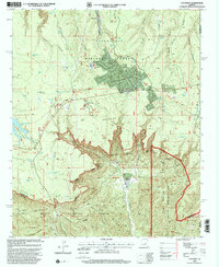
1990 Map of O W Point
USGS Topo · Published 2000About this map
The Mogollon Rim dominates this landscape on the boundary of the Sitgreaves National Forest and Tonto National Forest. In the late 20th century, the area shows a transition from traditional ranching and mining to recreational land use. The presence of the Canyon Creek Fish Hatchery and the General Crook National Recreation Trail highlights this shift toward public leisure, while the Rainbow Mines and the historic OW Ranch ground the map in its industrial and agricultural roots. Water management is a primary feature of this arid high-country terrain, evidenced by a dense network of catchments like Willow Springs Lake, Jacob Well, and Lonesome Lake. Residential developments such as Forest Lakes Estates and a nearby Mobile Home Park are situated along the Rim Road, illustrating the growth of seasonal and permanent settlements in this corner of Coconino and Gila Counties.
Find a feature on this map
75 named features on this map. Tap any name to fly to it.
Don’t see what you’re looking for? This feature index may not catch every label — zoom into the map to look around manually.
Map Details
Editions of this 1990 O W Point Map
3 editions found
Other maps of this area

1886 · Holbrook
USGS Topo · 1:250,000

1893 · Holbrook
USGS Topo · 1:250,000

1954 · Holbrook
USGS Topo · 1:250,000

1957 · Holbrook
USGS Topo · 1:250,000

1958 · Holbrook
USGS Topo · 1:250,000

1960 · Holbrook
USGS Topo · 1:250,000

1961 · Woods Canyon
USGS Topo · 1:62,500

1961 · Heber
USGS Topo · 1:62,500

1961 · Chediski Peak
USGS Topo · 1:62,500
1961 · Young
USGS Topo · 1:62,500