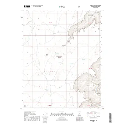
2018 Map of Buffalo Ranch
USGS Topo · Published 2018About this map
Buffalo Ranch sits on a high plateau between the protected wilderness of the Kaibab National Forest and the dramatic eastern rim of Grand Canyon National Park. This portion of Coconino County is defined by its verticality, where the Colorado River snakes through the depths of Marble Canyon, passing landmarks like Point Hansbrough and the Triple Alcoves. The reliance on local water management is evident in the numerous numbered reservoirs and basins scattered across the range, such as Navajo Tank, Burro Tank, and Tank Number Eight.
Find a feature on this map
30 named features on this map. Tap any name to fly to it.
Don’t see what you’re looking for? This feature index may not catch every label — zoom into the map to look around manually.
Map Details
Editions of this 2018 Buffalo Ranch Map
This is the sole edition of this map. No revisions or reprints were ever made.
Other maps of this area

1886 · Echo Cliffs
USGS Topo · 1:250,000

1886 · Kaibab
USGS Topo · 1:250,000

1891 · Echo Cliffs
USGS Topo · 1:250,000

1936 · Jacobs Lake
USGS Topo · 1:48,000

1940 · Jacob Lake
USGS Topo · 1:62,500

1953 · Jacobs Lake
USGS Topo · 1:62,500

1953 · Grand Canyon
USGS Topo · 1:250,000

1954 · Nankoweap
USGS Topo · 1:62,500

1954 · Emmett Wash
USGS Topo · 1:62,500

1956 · Marble Canyon
USGS Topo · 1:250,000