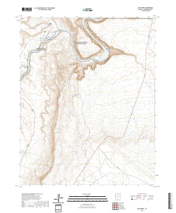
2021 Map of Lees Ferry
USGS Topo · Published 2021About this map
Lonely Dell Cem marks a historic footprint at the confluence of the Paria River and the Colorado River, a critical point of river crossing and settlement. This landscape is defined by the transitions between Grand Canyon National Park and the Glen Canyon National Recreation Area. The geography is dominated by sheer verticality, from the depths of Marble Canyon to the heights of Johnson Point and the towering Echo Cliffs to the south. Trails such as the Colorado River Trl and the Secret Beach Trl navigate the base of the cliffs, while the Pariah Road (Paved) provides access to the historic ferry site. Further south, the terrain opens into a series of washes and springs, including Navajo Springs, which historically served as a vital water source in this arid environment.
Find a feature on this map
29 named features on this map. Tap any name to fly to it.
Don’t see what you’re looking for? This feature index may not catch every label — zoom into the map to look around manually.
Map Details
Editions of this 2021 Lees Ferry Map
This is the sole edition of this map. No revisions or reprints were ever made.
Other maps of this area

1886 · Echo Cliffs
USGS Topo · 1:250,000

1891 · Echo Cliffs
USGS Topo · 1:250,000

1951 · Lees Ferry NE
USGS Topo · 1:24,000

1954 · Lees Ferry NW
USGS Topo · 1:24,000

1954 · Lees Ferry SE
USGS Topo · 1:24,000

1954 · Lees Ferry SW
USGS Topo · 1:24,000

1954 · Tanner Wash
USGS Topo · 1:62,500

1954 · Leche-E Rock
USGS Topo · 1:62,500

1954 · Lees Ferry
USGS Topo · 1:62,500

1955 · Tanner Wash NE
USGS Topo · 1:24,000