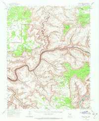
1962 Map of Kanab Point
USGS Topo · Published 1972About this map
Havasupai Indian Reservation lands sit at the southern edge of this 1962 topographic survey, where the turquoise waters of Havasu Creek flow toward the Colorado River. The intricate canyon systems of the Grand Canyon National Monument and Grand Canyon National Park meet here, revealing the transition from the Kanab Plateau down to the Middle Granite Gorge. Researchers can locate specialized sites like a Cem and Mine near the reservation boundary, alongside landmarks like Beaver Falls and Havasu Falls. The geography is defined by sheer drops and narrow passages, such as Hundred and Forty Mile Canyon and Specter Chasm. A few modern human touches, including a Campground and a Jeep Trail, provide evidence of recreational use and access during the early 1960s within the surrounding Kaibab National Forest.
Find a feature on this map
77 named features on this map. Tap any name to fly to it.
Don’t see what you’re looking for? This feature index may not catch every label — zoom into the map to look around manually.
Map Details
Editions of this 1962 Kanab Point Map
2 editions found
Other maps of this area

1886 · Kaibab
USGS Topo · 1:250,000

1953 · Grand Canyon
USGS Topo · 1:250,000

1954 · Heaton Knolls SE
USGS Topo · 1:24,000

1954 · Heaton Knolls
USGS Topo · 1:62,500

1957 · Grand Canyon
USGS Topo · 1:250,000

1957 · Jumpup Canyon
USGS Topo · 1:62,500

1958 · Grand Canyon
USGS Topo · 1:250,000

1958 · Big Springs
USGS Topo · 1:62,500

1960 · Grand Canyon
USGS Topo · 1:250,000

1962 · Kanab Point
USGS Topo · 1:62,500