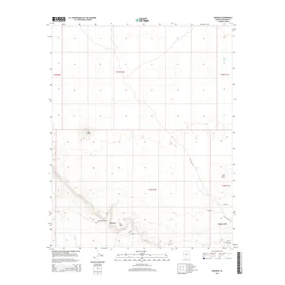
2014 Map of Moenave
USGS Topo · Published 2014About this map
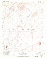
Moenave and the western edge of Tuba City anchor this high-desert landscape in northern Arizona. The topography is defined by significant relief, featuring the prominent Tuba Butte and the flat-topped Mori Mesa. Between these heights, Moenave Canyon cuts through the terrain, sheltering the Cliff Spring. The map documents a sparse but vital network of infrastructure, from the historic Tuba City-Gap Trl to modern connectors like Navajo Blvd. Scattered water sources such as Cattail Spring and Mesa Spring indicate the critical role of hydrology in this arid region. The presence of Flat Rock and various Bureau of Indian Affairs routes like Bia-1012 further underscores the unique land management and navigational patterns of the Painted Desert region during this era.
Find a feature on this map
20 named features on this map. Tap any name to fly to it.
Don’t see what you’re looking for? This feature index may not catch every label — zoom into the map to look around manually.
Map Details
Editions of this 2014 Moenave Map
This is the sole edition of this map. No revisions or reprints were ever made.
Other maps of this area

1886 · Echo Cliffs
USGS Topo · 1:250,000

1891 · Echo Cliffs
USGS Topo · 1:250,000

1955 · Moa Ave NW
USGS Topo · 1:24,000
1955 · Moa Ave SW
USGS Topo · 1:24,000

1956 · Marble Canyon
USGS Topo · 1:250,000
1957 · The Gap SW
USGS Topo · 1:24,000

1959 · Marble Canyon
USGS Topo · 1:250,000

1961 · Marble Canyon
USGS Topo · 1:250,000
1969 · Moenkopi
USGS Topo · 1:24,000
1969 · Tuba City
USGS Topo · 1:24,000