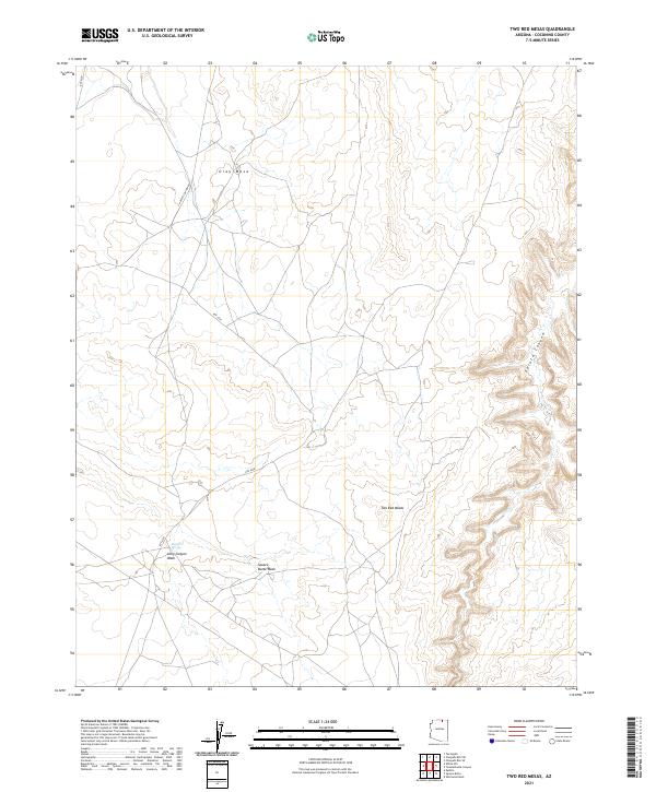
2021 Map of Two Red Mesas
USGS Topo · Published 2021About this map
Two Red Mesas and the broad profile of Gray Mesa anchor this landscape of the Arizona high desert within Coconino County. The terrain is defined by a network of drainage systems, including Long Canyon Wash and Square Butte Wash, which carve through the arid plateaus. Water resources are localized at points like Bennett Spring, a critical landmark in a region where surface water is otherwise scarce. The area is traversed by primitive routes such as Navajo Canyon Rd and Rte 6330, reflecting a sparse settlement pattern common in the expansive remote sections of the Navajo Nation. To the east, the topography becomes increasingly complex as the land descends into Potato Canyon, showing the intricate erosion patterns that characterize this portion of the Colorado Plateau.
Find a feature on this map
17 named features on this map. Tap any name to fly to it.
Don’t see what you’re looking for? This feature index may not catch every label — zoom into the map to look around manually.
Map Details
Editions of this 2021 Two Red Mesas Map
This is the sole edition of this map. No revisions or reprints were ever made.
Other maps of this area

1883 · Marsh Pass
USGS Topo · 1:250,000

1886 · Echo Cliffs
USGS Topo · 1:250,000

1891 · Echo Cliffs
USGS Topo · 1:250,000

1892 · Marsh Pass
USGS Topo · 1:250,000

1954 · Navajo Creek
USGS Topo · 1:62,500

1956 · Marble Canyon
USGS Topo · 1:250,000

1959 · Marble Canyon
USGS Topo · 1:250,000

1961 · Marble Canyon
USGS Topo · 1:250,000

1970 · Square Butte
USGS Topo · 1:24,000

1970 · Whirlwind Rock
USGS Topo · 1:24,000