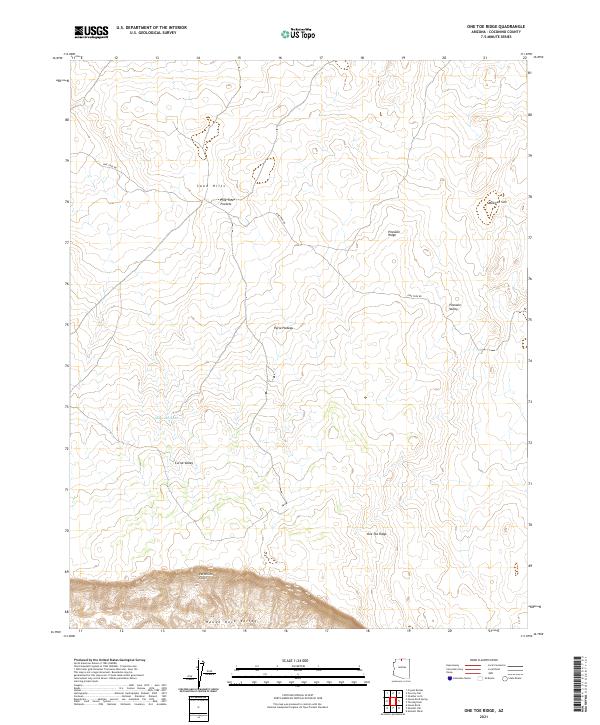
2021 Map of One Toe Ridge
USGS Topo · Published 2021About this map
Vermilion Cliffs dominate the southern landscape of this northern Arizona survey, dropping sharply into House Rock Valley. This high-desert terrain is defined by the massive Paria Plateau, where drainage and elevation changes create distinct geographic zones like Pinnacle Ridge and Corral Valley. The map reveals a land shaped by scarce water and cattle-ranging history, indicated by Moquitch Tank and the network of primitive tracks like Pine Tree Rd. Northward, the landscape transitions into the Sand Hills and the unique depression of Mexican Sink. The surveying detail captures the isolation of One Toe Ridge, providing a clear view of the complex topography before the plateau breaks toward the lower valleys.
Find a feature on this map
16 named features on this map. Tap any name to fly to it.
Don’t see what you’re looking for? This feature index may not catch every label — zoom into the map to look around manually.
Map Details
Editions of this 2021 One Toe Ridge Map
This is the sole edition of this map. No revisions or reprints were ever made.
Other maps of this area

1886 · Echo Cliffs
USGS Topo · 1:250,000

1886 · Kaibab
USGS Topo · 1:250,000

1891 · Echo Cliffs
USGS Topo · 1:250,000

1936 · Jacobs Lake
USGS Topo · 1:48,000

1940 · Jacob Lake
USGS Topo · 1:62,500

1953 · Jacobs Lake
USGS Topo · 1:62,500

1953 · Grand Canyon
USGS Topo · 1:250,000

1954 · Emmett Wash NE
USGS Topo · 1:24,000

1954 · Emmett Wash NW
USGS Topo · 1:24,000

1954 · Paria Plateau SE
USGS Topo · 1:24,000