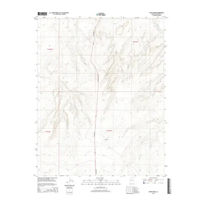
2014 Map of White Dome
USGS Topo · Published 2014About this map
White Dome rises as the central landmark of this high-desert landscape in northern Arizona, marking a terrain defined by dramatic elevation changes and arid drainage systems. The map traces the long path of Copper Mine Rd as it bisects the territory, providing a vital north-south link through the expansive plateaus of Coconino County. Water is a scarce and critical resource here, represented by the ephemeral Antelope Creek in the northeastern corner and the isolated White Dome Tank situated just south of the dome itself. This U.S. Geological Survey document captures the intersection of several townships, including t40n r9e and t39n r9e, illustrating the vast, sparsely populated grazing lands and technical surveying boundaries that characterize this portion of the Navajo Nation and its surrounding environment.
Find a feature on this map
8 named features on this map. Tap any name to fly to it.
Don’t see what you’re looking for? This feature index may not catch every label — zoom into the map to look around manually.
Map Details
Editions of this 2014 White Dome Map
This is the sole edition of this map. No revisions or reprints were ever made.
Other maps of this area

1886 · Echo Cliffs
USGS Topo · 1:250,000

1891 · Echo Cliffs
USGS Topo · 1:250,000

1951 · Lees Ferry NE
USGS Topo · 1:24,000

1954 · Lees Ferry SE
USGS Topo · 1:24,000

1954 · Tanner Wash
USGS Topo · 1:62,500

1954 · Leche-E Rock
USGS Topo · 1:62,500

1954 · Lees Ferry
USGS Topo · 1:62,500

1955 · Tanner Wash NE
USGS Topo · 1:24,000

1956 · Marble Canyon
USGS Topo · 1:250,000

1959 · Marble Canyon
USGS Topo · 1:250,000