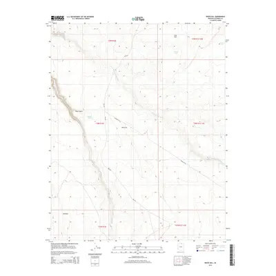
2014 Map of White Hill
USGS Topo · Published 2014About this map
White Hill rises as a central landmark in this high-desert landscape within the Navajo Nation, north of the community of Kaibito. The map documents a rugged terrain defined by significant drainage systems and geological formations, including Chaol Canyon and the expansive Gray Mesa to the north. Seasonal water sources are critical to this arid environment, evidenced by named features like Déjolie Tank, Wooded Tank, and Red Dirt Tank, which support local land use and grazing.
Find a feature on this map
18 named features on this map. Tap any name to fly to it.
Don’t see what you’re looking for? This feature index may not catch every label — zoom into the map to look around manually.
Map Details
Editions of this 2014 White Hill Map
This is the sole edition of this map. No revisions or reprints were ever made.
Other maps of this area

1883 · Marsh Pass
USGS Topo · 1:250,000

1886 · Echo Cliffs
USGS Topo · 1:250,000

1891 · Echo Cliffs
USGS Topo · 1:250,000

1892 · Marsh Pass
USGS Topo · 1:250,000

1954 · Navajo Creek
USGS Topo · 1:62,500

1956 · Marble Canyon
USGS Topo · 1:250,000

1959 · Marble Canyon
USGS Topo · 1:250,000

1961 · Marble Canyon
USGS Topo · 1:250,000

1970 · Square Butte
USGS Topo · 1:24,000
1970 · Chaiyahi Rim SW
USGS Topo · 1:24,000