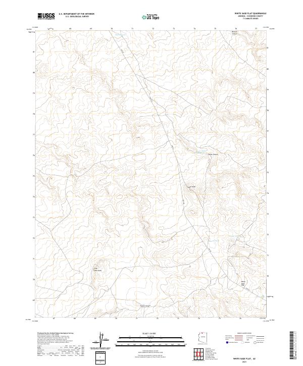
2021 Map of White Sage Flat
USGS Topo · Published 2021About this map
Ryan Rd winds through a high plateau landscape in Coconino County, serving as the primary corridor across this expansive portion of northern Arizona. The area is defined by its water management systems, including Whiting Tank, Jensen Tank, and the Cedar Ridge Reservoir, which are vital infrastructure for ranching and land use in this arid environment. The map details a series of geological formations that break the plateau, such as Wildcat Canyon and Jacob Canyon, alongside distinctive high points like Cedar Knoll and Little Cedar Knoll. At the southeastern edge of the sheet lies the namesake White Sage Flat, a broad expanse that illustrates the transition between the rolling uplands and the deep drainages of Pigeon Canyon.
Find a feature on this map
16 named features on this map. Tap any name to fly to it.
Don’t see what you’re looking for? This feature index may not catch every label — zoom into the map to look around manually.
Map Details
Editions of this 2021 White Sage Flat Map
This is the sole edition of this map. No revisions or reprints were ever made.
Other maps of this area

1886 · Kaibab
USGS Topo · 1:250,000

1953 · Grand Canyon
USGS Topo · 1:250,000

1954 · Shinarump NW
USGS Topo · 1:24,000

1954 · Fredonia NE
USGS Topo · 1:24,000

1954 · Fredonia
USGS Topo · 1:62,500

1957 · Grand Canyon
USGS Topo · 1:250,000
1957 · Shinarump NE
USGS Topo · 1:24,000

1957 · Shinarump SE
USGS Topo · 1:24,000

1957 · Shinarump SW
USGS Topo · 1:24,000
1957 · Shinarump
USGS Topo · 1:62,500