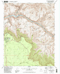
1988 Map of Phantom Ranch
USGS Topo · Published 1988About this map
Phantom Ranch serves as a focal point at the junction of Bright Angel Creek and the Colorado River, highlighting the logistical network within the Grand Canyon National Park during the late 1980s. The map illustrates the vertical complexity of the landscape, from the inner depths of the Granite Gorge to the high rim overlooks at Yavapai Point and Mather Point. A series of infrastructure markers, including Gaging Stations, a Heliport, and a Tunnel, trace the human effort to monitor and navigate this environment.
Find a feature on this map
60 named features on this map. Tap any name to fly to it.
Don’t see what you’re looking for? This feature index may not catch every label — zoom into the map to look around manually.
Map Details
Editions of this 1988 Phantom Ranch Map
2 editions found
Other maps of this area

1886 · San Francisco Mtns
USGS Topo · 1:250,000

1886 · Chino
USGS Topo · 1:250,000

1886 · Echo Cliffs
USGS Topo · 1:250,000

1886 · Kaibab
USGS Topo · 1:250,000

1891 · San Francisco Mtns
USGS Topo · 1:250,000

1891 · Chino
USGS Topo · 1:250,000

1891 · Echo Cliffs
USGS Topo · 1:250,000

1894 · San Francisco Mtns
USGS Topo · 1:250,000

1899 · San Francisco Mtns
USGS Topo · 1:250,000

1903 · Bright Angel
USGS Topo · 1:48,000